

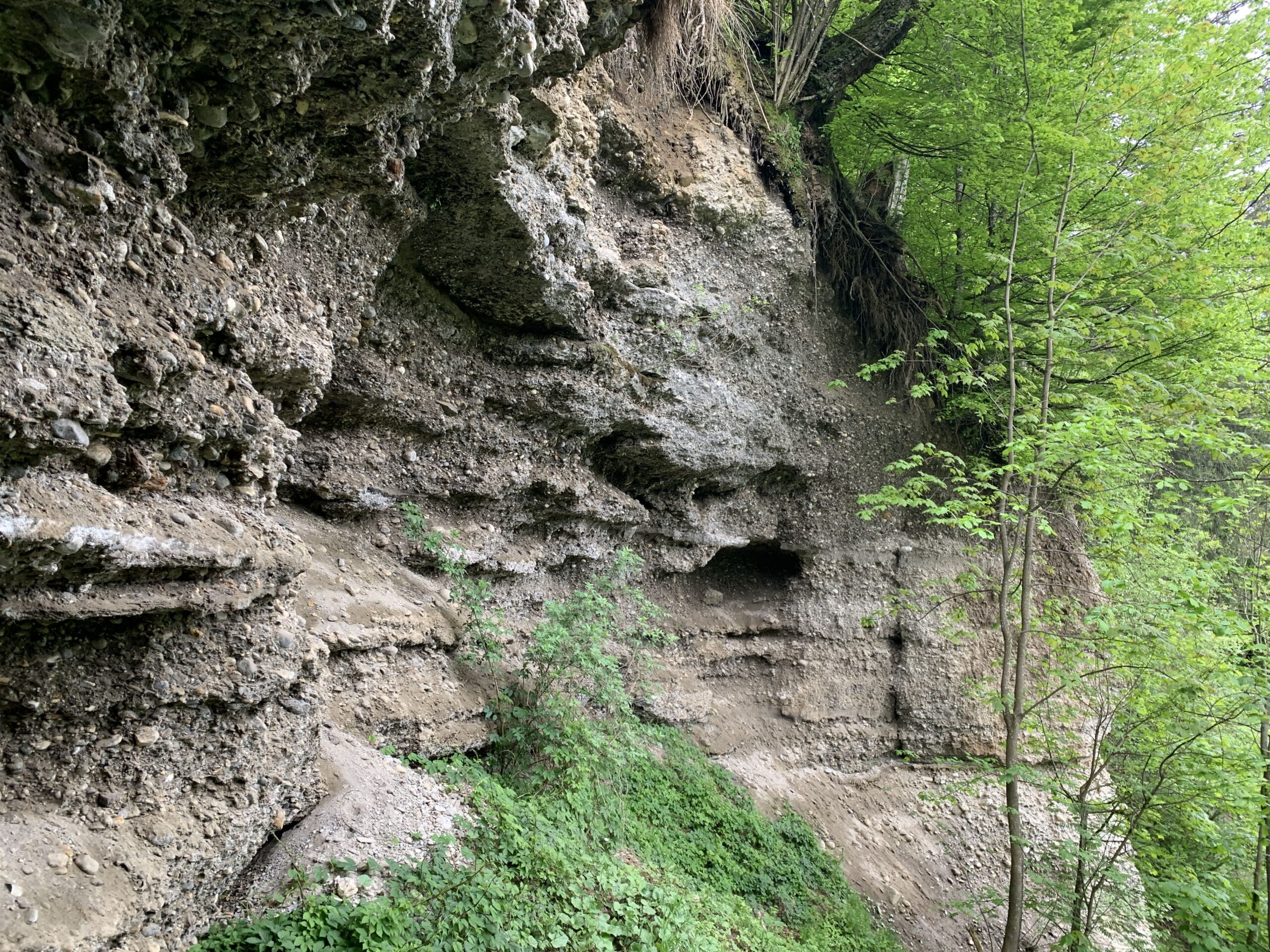
Maximilian's Cave
The Maximilian‘s Cave was located on the
slope from Buchberg to Bischofshofen
and was counted among the small caves.
It was up to 17 meters wide, 8 meters
deep, and approximately 2 meters high,
situated in a so-called "Talrandverkittung"
at about 650 meters above sea level. The
cave was first described in 1926 by Walter
von Czoernig. At that time, he mentioned
some benches allegedly located inside the
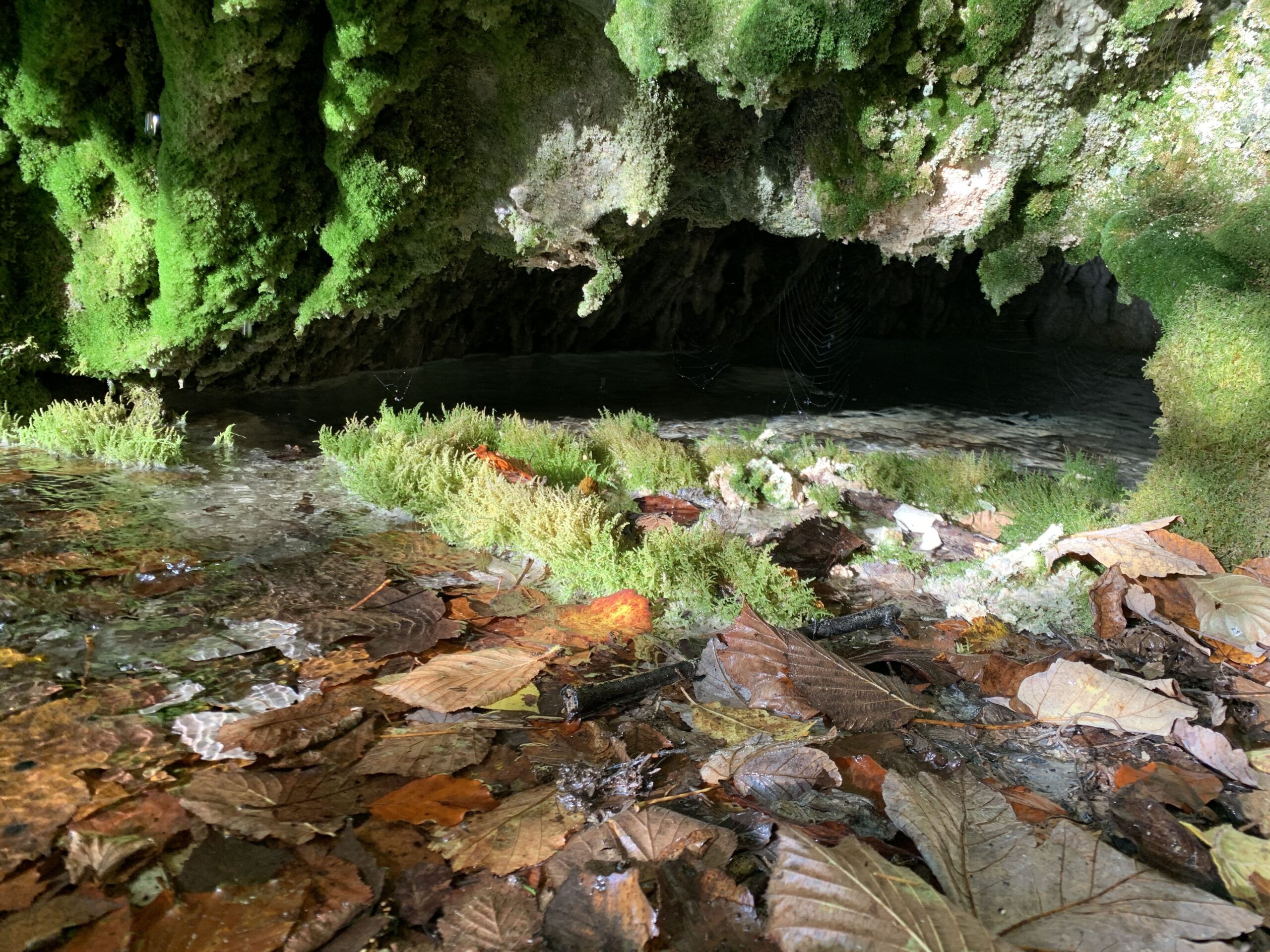
cave. Today, there is nothing left of the
cave. Such semi-caves are widespread in
cemented terrace gravels.
The deeper the depressions, the greater the risk
of collapse for these semi-caves. Several small
semi-caves are located next to the Erzweg,
reminiscent of Maximilian‘s Cave.
The gravel transported by streams from the
Tauern region contained lime-rich water. Due
to the excess of lime in the percolating water,
the individual components were effectively
cemented together.
Kids
What is biodiversity?
Of all the planets in our solar system, only Earth is home to living creatures - and many different species at that! Scientists estimate that our planet is home to more than 8 million plant and animal species, but only 1 million have been discovered so far! Biodiversity or biological diversity refers to every living thing on earth. This includes the single-celled bacteria in our soils, the fungi, trees and flowers that grow in our gardens and forests and the animals that live in the oceans and on land. Of course, we humans are also part of the Earth's biodiversity!
This wealth of life forms helps to make our planet a place worth living on. Imagine if there was only one kind of living creature on earth! How would they eat, breathe and live? Organisms - including us humans - are interdependent. Biodiversity provides us with food, produces the oxygen we breathe, purifies our water and helps to maintain our health and well-being! Without biodiversity, life as we know it would not exist!
What is biodiversity?
Of all the planets in our solar system, only Earth is capable of harbouring life: from the bacteria in our soils to the fungi, trees and flowers that grow in our gardens and forests, to the animals that live in the oceans and on land.
This remarkable variety of life forms on Earth is referred to as biodiversity or biological diversity. Biodiversity can be described as the number of species living in a particular habitat and the types of ecosystems in a particular place. A species is made up of individuals that share certain characteristics and can reproduce among themselves. An ecosystem, on the other hand, is made up of organisms that interact with each other and with the non-living things in their environment.
The Earth contains different types of habitats and ecosystems such as forests, coral reefs and grasslands. However, because the oceans and land are so vast, no one knows the exact number of species that currently exist. Scientists estimate that there are more than 8 million animal and plant species, but only 1 million have been described so far! This figure does not even include the diversity of fungi and bacteria!
This wealth of life forms contributes to making the earth a place worth living on. Organisms - including us humans - interact with each other, i.e. they influence each other and are dependent on each other. In fact, every organism plays a role in this complex web of life. For us humans, biodiversity provides food, raw materials, oxygen and clean water - among many other resources. Many biological and natural processes contribute to hazard defence, fight diseases and maintain our general health and well-being.
Without biodiversity, there is no life as we know it!
What is biodiversity?
Of all the planets in our solar system, only Earth is capable of harbouring life: plants, animals and even single-celled organisms such as bacteria. This remarkable variety of life forms on Earth is known as biodiversity.
Biodiversity can be explored on three interconnected levels that reflect the complexity of life and the connections between organisms.
Genetic diversity is the diversity of genes within a single species. A species is defined by individuals that are genetically similar enough to reproduce with each other. However, each member may have slight differences in genetic make-up. This is the reason why no two people are exactly alike and why there are different populations! These small differences in genetic make-up are extremely important in determining whether or not an individual can adapt to changes in its environment and survive.
Biodiversity refers to the diversity of species in an area or a specific habitat, while the diversity of ecosystems encompasses the diversity of habitats and communities. Each organism plays a role in its respective ecosystem, so biodiversity also includes the interactions of organisms with each other and with their environment. Some of the most complex ecosystems are found in coral reefs and tropical rainforests. Although they cover less than 10 % of the Earth's surface, they harbour the greatest biodiversity in the world. Coral reefs harbour around 25 % of the approximately 240,000 known marine species, while rainforests are home to half of all known living plant and animal species on land. A single hectare of rainforest alone can harbour 42,000 insect species and 300 tree species!
Other habitats such as deserts and arctic regions have a lower biodiversity, but are just as important. The species they harbour are all ecologically important and many of them are only found in these regions.
This wealth of life not only makes the earth unique among the planets - it also makes it a place worth living in. Organisms interact, influence and depend on each other. Biodiversity and ecosystems provide us with a variety of services, such as pollination, water purification, decomposition and nutrient cycling, and climate regulation - all of which help to sustain various aspects of our lives, from our basic needs to our health, safety and cultural needs. In addition to the practical benefits for humans, biodiversity also has its own value: every organism has the right to develop and live! Without biodiversity, life as we know it would not exist!
