

Miner's Footpath - One tells oneself...
The path to the historical mining sites
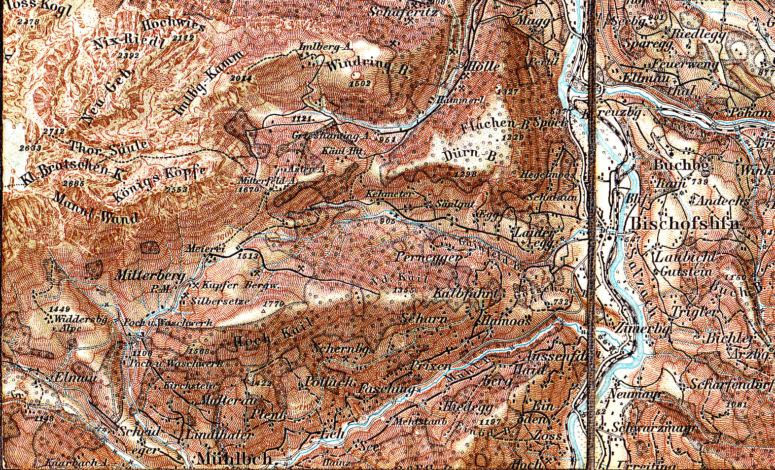
led over Götschenberg and Haidberg mountains (Bischofshofen) to Mitterberg (Mühlbach am Hochkönig). This path was used from prehistory (Bronze Age) for generations until the construction of the road from Bischofshofen to Mühlbach in 1879 and is a historic path landmark in the Ore of the Alps UNESCO Global Geopark.
Fritz Hörmann writes in the communal history of Mühlbach am Hochkönig
(2012): “If the history of its origin is correct, it is also most likely that the path from Götschenberg lead from Lainbichl, Kalbfahrt, Prechtlmoos, Wolfgrube and Jagermahd to the Mitterbergalpe, or to the pit built by the old miners, thus creating
a connection between the deposit and work site on Götschenberg mountain.
The fact that the path is laid out in the best possible twists and turns, and is even deeply cut in places and does not run uphill and downhill like a farmer’s path, should support this view. On the Götschenberg plateau, stone for axes was cut; mallets, rubbing stones and grinding stones were made, and cereal grains ground into flour [... ].”
Kids
The Knappensteig
The Knappensteig is an old path that miners used to walk from Bischofshofen to Mühlbach am Hochkönig. It has many bends so that people could carry their things more easily back then. The path was important for a long time until they built a road in 1879. The path to the Arthurhaus in Mühlbach is around 8.5 kilometres long and goes uphill for around 1000 metres in altitude. There is also a ski area at the Arthurhaus on the Hochkeil. The Knappensteig is actually the longest route that is particularly suitable for skiers in winter.
The Knappensteig
The Knappensteig is an old path that was once used by miners to get from Bischofshofen to Mühlbach am Hochkönig. It has many bends, which were specially built so that goods could be transported easily. This path was in use for a long time until a proper road was built from Bischofshofen to Mühlbach in 1879. The hiking trail is around 8.5 kilometres long and starts in Bischofshofen at the ski jump area. You have to climb around 1000 metres in altitude to get to the Arthurhaus in Mühlbach am Hochkönig. There is a ski area on the Hochkeil. The Knappensteig is also the longest prepared route for ski tours in the Eastern Alps and is popular with skiers.
The Knappensteig
The Knappensteig is a historic path that leads from Bischofshofen to Mühlbach am Hochkönig. The Knappensteig used to be the miners' transport route. The many twists and turns in the path were created so that goods could be transported easily. This path was used for generations until the road was built in 1879.
The approx. 8.5 km long hiking trail leads directly from Bischofshofen from the ski jump area to the Arthurhaus in Mühlbach am Hochkönig. After conquering the almost 1000 metres in altitude, you reach the Arthurhaus with the ski area on the Hochkeil. The Knappensteig is the longest groomed ski tour descent in the Eastern Alps, which is popular with ski enthusiasts.
