

Feldmaier Creek - Landscape
The small, steep Feldmaier creek, which
runs from the Feldmaier farm in the north
through the village of Pichl (794 m, west of
St. Veit) to its confluence with the Wenger
creek to the north-east of the Schernberg
Castle in the south, is a typical gorge-like
mountain creek.
From a geological point of view, the
Feldmaier creek is located in the area of
the greywacke zone.
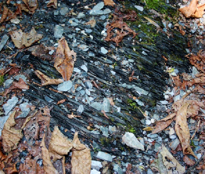
The creek is laid out in what are known as Wildschönauer slates (Upper Ordovician
to Devonian, 485 - 420 million years)
and runs through very fi nely divided and
extremely thin-fl aked, black phyllites here
in the Pichl area. Harder calcareous phyllite
layers can also be found to the north of
Pichl, which cross the creek bed almost at
right angles.
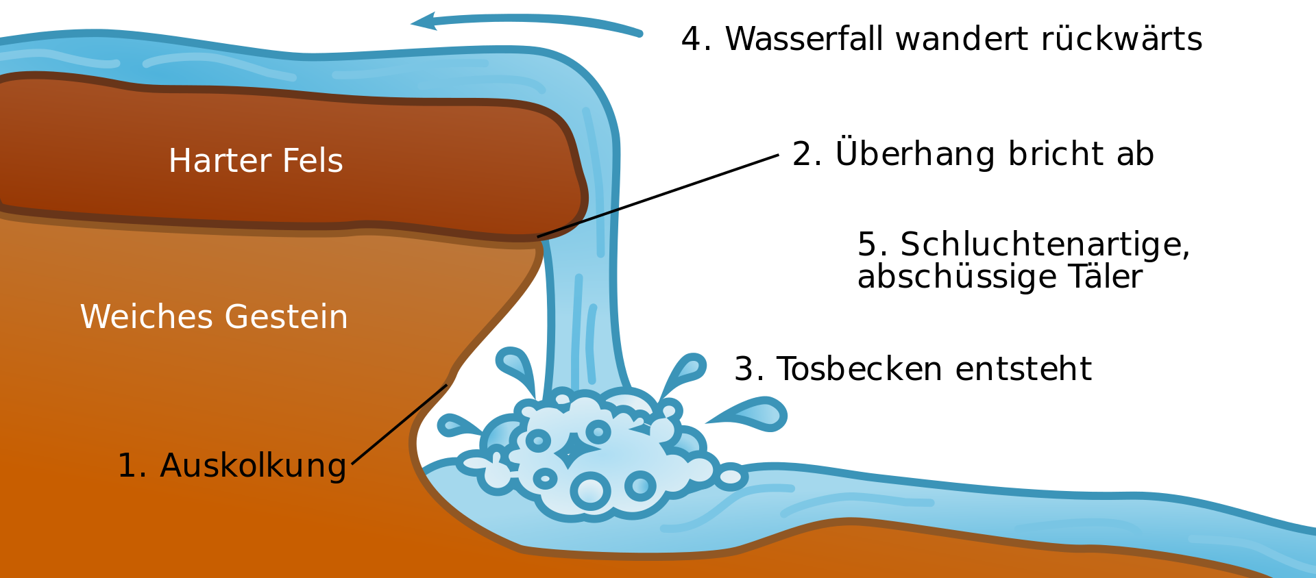
A small waterfall that falls from a height
of around 6 meters and has a gradient
of around 45° offers a special natural
spectacle. In the summer months
(especially when there is little rainfall),
the stream does not carry quite as much
water, but normally the water literally
“shoots” down the embankment. At about
670 m, the Feldmaier creek fl ows into the
Wengerbach creek in the deeply indented
gorge of the Putzengraben trench.


